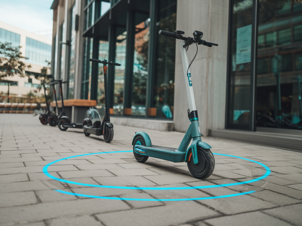
I remember the first time I rode an e-scooter through a city center: it felt like unlocking a new layer of urban mobility—fast, flexible, and oddly liberating. But that same technology also brought me face to face with a persistent tension: how do cities control where scooters go and park without turning public space into a sensor-studded panopticon? Geofencing is the answer many municipalities have adopted, but it raises real questions about privacy, surveillance, and civic trust. Here’s how I think cities can deploy e-scooter geofencing responsibly—protecting public space and riders’ rights while keeping sidewalks safe and streets orderly.
What is geofencing, really?
At its simplest, geofencing creates virtual boundaries on a map. When a device—like an e-scooter—enters or exits one of those boundaries, predefined rules trigger: speed limits slow the scooter, parking locks prevent a ride from ending in a no-park zone, or the scooter is disabled entirely in sensitive areas (think waterfronts, airports, or pedestrian plazas). Cities use geofences to protect pedestrian areas, ensure accessibility, and reduce clutter. Operators use them to prevent misuse and lower operational costs.
Why privacy and surveillance concerns are legitimate
People worry that geofencing requires constant, detailed tracking of every scooter and rider, feeding municipal databases that could be repurposed for broader surveillance. Those fears aren’t hypothetical: location data can be sensitive. Re-identification of riders from aggregated datasets is possible, and data breaches or mission creep can turn beneficial management tools into intrusive monitoring systems.
It’s also about perception. Even if the technical design minimizes privacy risks, the sight of geofences tied to city infrastructure can feel invasive if there’s no transparency or clear limits on data use.
Design choices that reduce privacy risks
Not all geofencing systems are built the same. The architecture and policy choices cities and operators make determine whether geofencing respects civic space or undermines it.
- On-device enforcement: One powerful privacy-preserving approach is to run geofence checks directly on the scooter or the rider’s phone. That means the device evaluates location locally and enforces rules without sending continuous location streams to a central server. When a scooter slows in a geofence, it can do so based on locally stored map data and periodic updates, limiting the volume of data leaving the device.
- Edge verification with minimal telemetry: Where operators need to confirm compliance, systems can send occasional, hashed telemetry rather than continuous raw GPS traces. For instance, a scooter could report “compliant” or “non-compliant” events tied to random identifiers that rotate frequently, reducing the risk of tracking individual riders over time.
- Aggregation and blurring: If a city needs insights about usage patterns, data can be aggregated and spatially blurred before analysis. Ten-meter precision isn’t necessary to know that scooters cluster in a neighborhood; coarser granularity satisfies planning needs while protecting individual privacy.
- Short retention and purpose limitation: Data should be stored only as long as required for the stated purpose—enforcement, maintenance, or planning—and then purged. Clear policies prevent function creep where mobility data later gets reused for policing or other unrelated surveillance.
Governance, transparency, and public trust
Technical safeguards only go so far. For me, the social contract around data matters as much as the code.
- Publish clear rules: Cities should publish their geofencing policies in plain language: what data will be collected, who will access it, how long it will be kept, and what it won’t be used for. That builds accountability.
- Public engagement: Geofencing maps should not be drawn behind closed doors. Hold public consultations, include disability advocates (geofences often touch curb ramps and walkways), and publish draft geofence layers for comment.
- Independent audits: Regular third-party audits of both operator systems and municipal data practices can identify privacy risks and confirm compliance with stated rules.
- Data access controls: Limit access to mobility data to a small set of authorized personnel with legitimate needs. Use role-based access and logging so any queries are recorded and auditable.
Open standards and interoperable approaches
I’m convinced the best long-term strategy is standardization. When operators and cities rely on proprietary, closed systems, it’s harder to verify privacy claims and harder for new entrants to compete fairly.
- Open geofence formats: Standard file formats for geofence definitions (with cryptographic signatures for authenticity) allow independent verification and easier public review.
- Privacy-preserving APIs: APIs designed with minimal data exchange in mind—think event-based hooks rather than continuous tracking endpoints—help operators comply without centralizing sensitive streams.
- Interoperability for enforcement: If multiple operators serve a city, standardized enforcement mechanisms mean consistent rider experience and make audits easier.
Practical policies cities can adopt today
Based on conversations with municipal staff, privacy advocates, and operators like Lime and Bird, these steps are practical and implementable.
- Require on-device geofence enforcement where possible: Contracts with operators should prioritize local enforcement and limit server-side tracking.
- Mandate data minimization and short retention: Define specific retention windows—e.g., telemetry older than 30 days is deleted unless linked to a safety investigation.
- Ban real-time geolocation sharing with law enforcement without a warrant: Mobility operators should publish transparency reports for any data requests they receive.
- Publish geofence maps and rationales: Make machine-readable geofence layers available so researchers can analyze them and the public can see why boundaries exist.
- Implement privacy impact assessments (PIAs): Before deploying geofences, cities should perform PIAs and make them public.
Examples worth watching
Some cities and companies are experimenting with privacy-forward models. Oslo and Helsinki have emphasized data minimalism in micromobility contracts. Certain pilots use “dark geofences” (rules enforced locally with no central reporting) to protect sensitive areas. On the vendor side, I’ve seen systems that rotate identifiers frequently and only send compliance events rather than raw traces—simple design choices that materially reduce surveillance risk.
Questions I often hear—and how I answer them
- Does geofencing require continuous tracking? No. Continuous tracking is an option, not a requirement. With the right architecture, enforcement can happen locally or via sparse, purpose-limited reporting.
- Won’t aggregation still let you identify people? Aggregation helps, but re-identification is a risk if datasets are rich. That’s why blurring, thresholding (only report if there are X+ scooters), and short retention are crucial.
- Can we trust private operators? Contracts, audits, and legal protections build trust. Operators also have business incentives to avoid privacy scandals that undermine ridership.
- What about equity—do geofences push scooters out of low-income areas? That’s a policy decision. Cities should monitor access and avoid creating rules that disproportionately limit mobility where it’s needed most.
Geofencing doesn’t have to mean surveillance. With thoughtful technical design, transparent governance, and firm legal limits, cities can keep sidewalks clear and protect public spaces without converting every scooter ride into a tracked record of movement. The choice isn’t between no rules and total surveillance—it’s about making rules that respect privacy, accountability, and the public interest.